PCT 2015 Day 90: A disappearing mountain
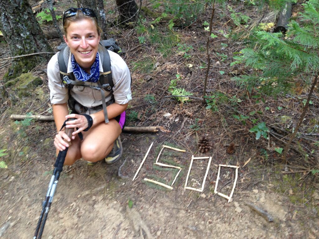
- Start: 1,478.5
- End: 1,502.3
- Miles: 23.8
- Camp: Lake Shastina with JoAnn
Today was a race to town amid the sun and smoke. We had the rest of the hill to climb up from camp, just under three miles, and then a gradual downhill for two miles and a steeper downhill for three more before our first intended stop. We marched up the first hill at over three miles an hour, stormed past the first creek and everything looked great. Then we met overgrown bushes which dragged us back and brought the average down. Still, we were making good time and couldn’t complain. The trees masked the haze although they couldn’t hide the humidity from the cloudy sky. At least it was a few degrees cooler for it.
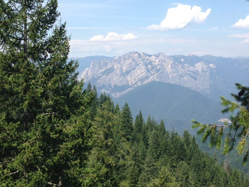
At Squaw Valley Creek, we met the other hikers in the bubble; Tink and Davy Crockett, Icebath, Firecracker and Big Fish, and Punky. Water bringing us all together again. We set off up the hill after everyone else, having come from further away that morning, but overtook all of them plus a couple of others well before the top. We were crushing it. I made it to the peak with tired feet and legs but barely out of breath, and was once again reminded just how far I have come as a hiker. We stopped for a mini rest, and looked out over the valley. Mount Shasta had gone! We could see a tiny peak which looked a similar shape, but way too small. After a couple of minutes we were able to make out the shadow of Shasta in the smokiness, barely visible especially with its snow covered tip. Terrifying.

We took the break time to call JoAnn, a trail angel near Mount Shasta, to see if she could accommodate us overnight. She not only agreed to let us stay with her but also said she would collect us from the trail, do our laundry, feed us, and drive us back when we needed. As if we needed any more incentive to speed down the hill! We entered the forest soon after the peak, and hiked about a mile before I spotted a side trail that would take us down a steeper but more direct path along the ridge and down the nose rather than switching back along the side of the hill. Being bored of forest switchbacks, we were agreed that we should try it. It brought us out at the dirt road I had seen on the map, which met the PCT on its route anyway. In no time at all we were passing the welcome sign to Castle Crags State Park and heading towards the roar of the Interstate. Barely ten minutes after we sat down, JoAnn came by to pick us up, take us grocery shopping and then drive us to her home in Lake Shastina, north of Weed.
As we drove north, we could see Mount Shasta again, far more clearly after the afternoon breeze blew the smoke away. It looks so much more normal up close, compared to its isolated, imposing profile from a distance. There is nothing within 10,000ft of its heights nearby so it stands out when you see it set in a landscape. JoAnn and Emory have a wonderful view of it from their back windows.
Tomorrow we will do laundry and zero with JoAnn and Emory, and I’m looking forward to not moving very much. I’ve hiked over 300 miles in the last two weeks since my last zero day. Rest time.
Leave a Reply