CDT 2023: Day 1
- Start: Chief Mtn Alternate mile 0
- End: Chief Mtn Alternate mile 6.1
- Miles: 6.1
- Camp: Gable Creek Campground
What a day!
I’d not been sure I was going to hike the CDT at all this year, although it’s been on my mind for a while now. However, I’d reserved permits for Glacier National Park (the CDT southbound start point) earlier in the year as I’d had a week’s hiking with a buddy already in the diary, so despite the fairly last minute decision to attempt the whole trail, I didn’t have the permit wrangling that a lot of the other hikers seemed to. As it happened, my buddy couldn’t make a backcountry trip in the end, and so we settled on a quick morning hike in Waterton Lakes before I’d cross the border and hike south alone.
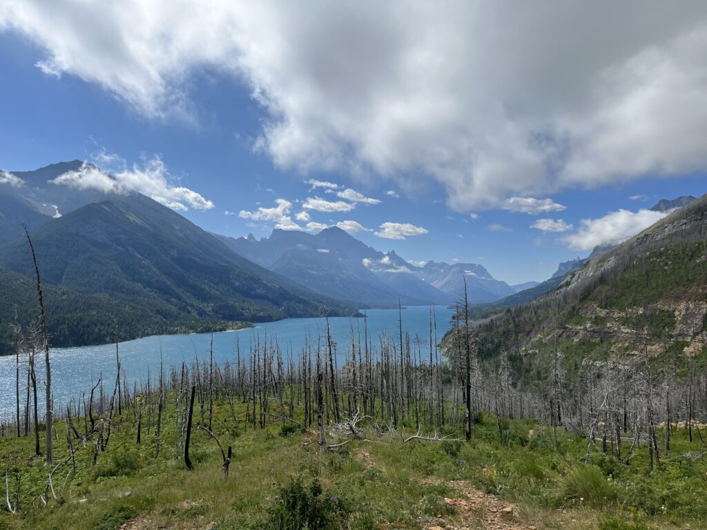
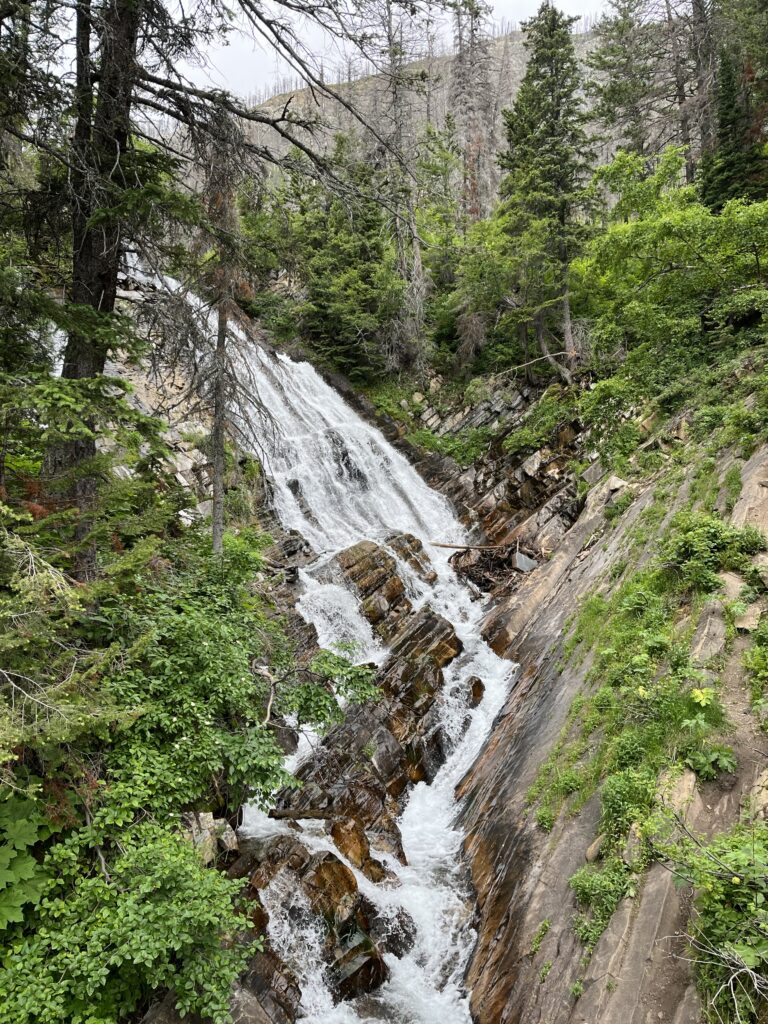
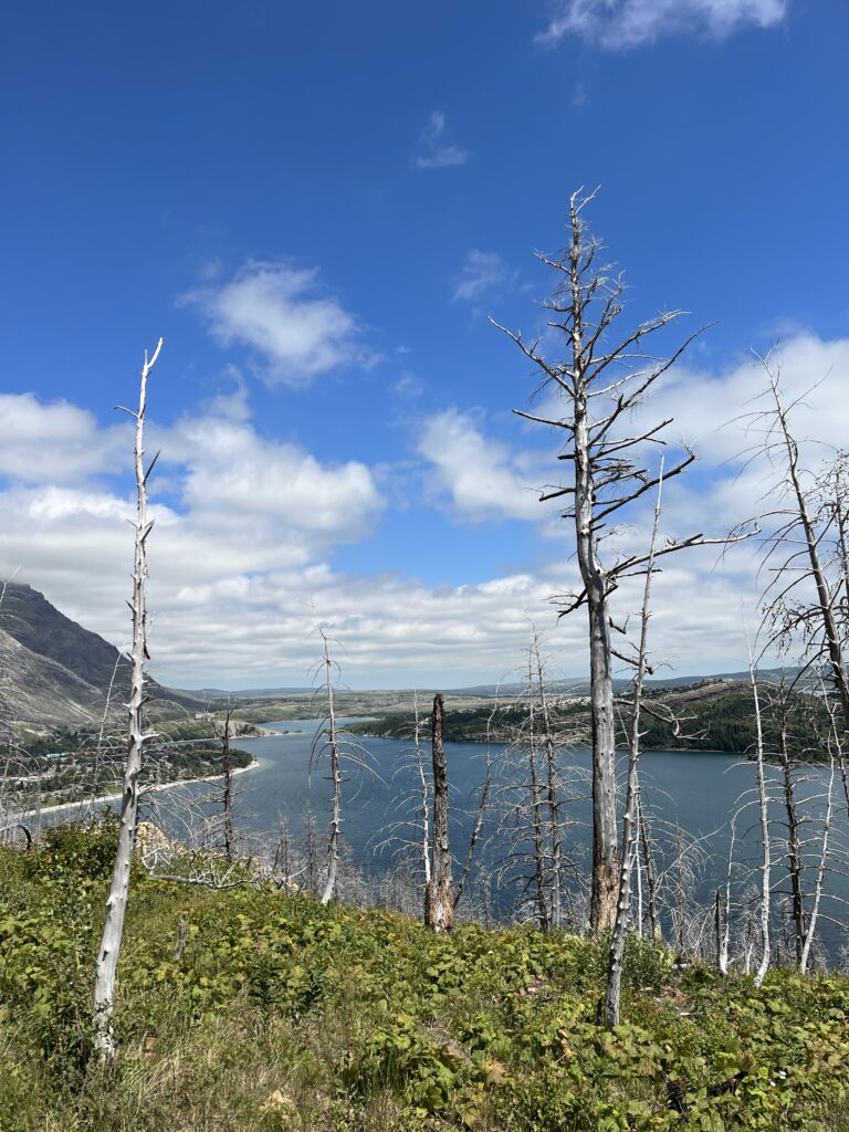
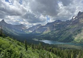
We chose a trail heading up to Bertha Lake and back, 7 miles out and back with over 1,200 feet of elevation gain. It was a fairly cloudy morning, the only sunshine over the southern end of the lake, but for hiking it was perfect – cloud cover and cool temperatures for the ascent up to the lake. The switchbacks up the steeper parts meant we had repeated views over the lake and the cut from the falls, and I was hooting with excitement every few yards. It was a lovely morning with my friend, a few short but sweet hours that don’t happen super often since his move to Calgary. By the time we descended the trail, it was significantly sunnier and significantly busier with lots of people with bear bells (why? Surely they aren’t loud enough to deter bears, just loud enough to intrigue them?), regular street clothes, and babies in portachairs.


On our return I tried to pick up the permit in Waterton (technically allowed) but discovered two things:
1. It’s not actually an issuing office and they can’t just print off the permits, they have to call Apgar (seemingly the busiest office in Glacier) and hope they get through (most times they don’t) and pass the Apgar ranger over to the permit holder to confirm everything before Apgar then email the confirmed permit over for printing. Long winded. Both the Waterton and Apgar rangers were simultaneously apologetic and complaining about the system themselves.
2. There were no alternative arrangements in place for the closure of the Many Glacier campground to tent camping, due to a bear incident (apparently someone left their food out, and a bear got it and keeps going back to the same spot). That meant that suddenly the second night dropped out of my 5-night itinerary meaning I’d have to forfeit the whole itinerary and rebook if we couldn’t find an alternative (we couldn’t).
Eventually we went for just splitting the permit into two, paying an extra permit fee, and having a hole in the itinerary where I would have to find some other solution, probably including hiking out of the park and somehow getting a ride to Babb.
Some snags with the CBP ROAM app for remotely reporting US entry (my new passport has neither a visa nor an ESTA attached to it since my visa is in my expired passport. It’s entirely permitted to travel use the visa as long as you travel with both passports, but the app couldn’t cope with that complexity!) had meant I couldn’t continue my journey through Glacier from Waterton, so I was planning to stick with my original permit options from Chief Mountain where there’s a manned border crossing. However, during the hour and a half I’d spent on the phone to Apgar trying to reroute around the Many Glacier closure, I’d missed my shuttle to the border. Thankfully my friend agreed to drive me the extra 30 mins which was super lovely of him, and it was great to spend the extra time with him. We’d tried to eat lunch in a grill in town, but I’d been tied up on my long phone call and it hadn’t been super social. The call combined with the impending shuttle departure time meant I’d also only crammed down a few fries, so I was able to use the car ride to finish my lunch as well!
I’d offered the spare slot on the permit into the CDT hiker group on social media and had been contacted by Tangent. We agreed to meet at the border, though he’d wait for a confirmation from me in East Glacier before shuttling to the trailhead. After the long call to the rangers, I was able to confirm to Tangent that everything was sorted; which turned out to be about 5 minutes before he called his border shuttle to cancel. Just in time! We agreed to meet at the border as planned at around 4pm.
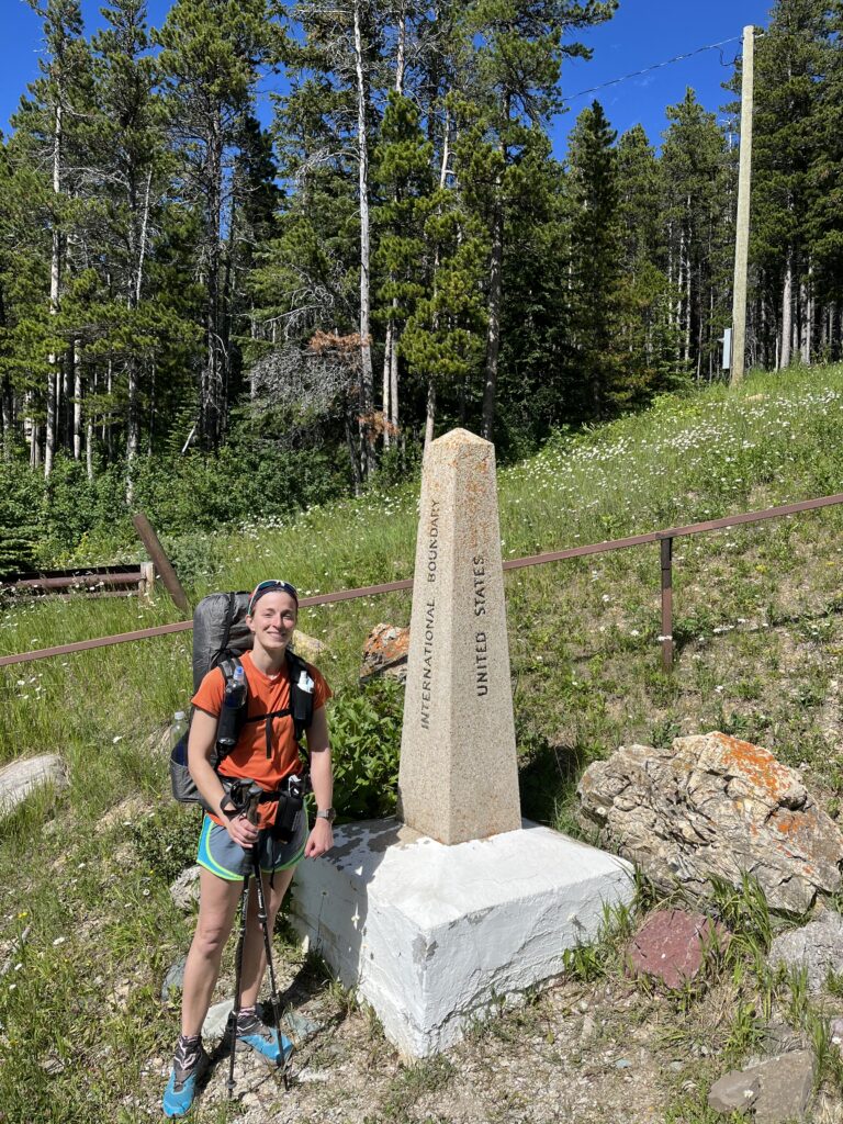
I said goodbye to my friend at the border, and headed into the US alone. The border agent was a delight and let me backtrack to the monument when Tangent arrived to get a starting photo.
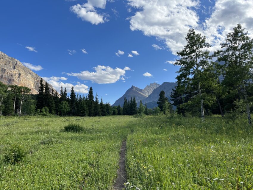
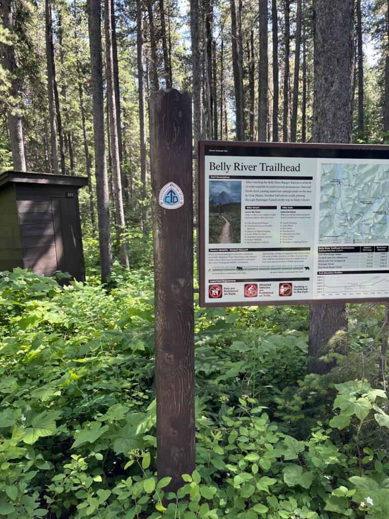
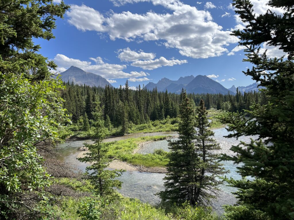
The Belly river trail was nice and easy and it was only 6 miles up to the first night’s campground. The river wound through open meadows filled with wildflowers and we could see the mountains in the distance growing ever closer.


At camp we met Ali and Andrew from Australia, and Nate from Indiana, who had all met the previous day at Slide Lake. Nate is a teacher and cyclist on vacation for a few days, and he had a spot on his permit for Poia Lake the next night which we accepted immediately, it being slightly closer than’ our original Many Glacier reservation. That meant a shorter day tomorrow and a longer one Tuesday, which was fine by me. We talked as we made dinner, the subjects roaming from bears and cats to gerrymandering and redundancies. It was a lovely mix of people, and we planned a late start for the morning so we could hike out as a group of five as far as Elizabeth Lake where Ali and Andrew would stop for the day. Things work out in the wild more often than not.

Leave a Reply