PCT 2015 Day 120: Water, water everywhere

- Start: 2,099.6
- End: 2,121.4
- Miles: 21.8
- Camp: Salvation Spring
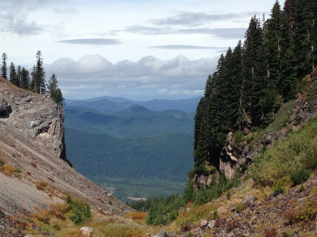
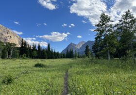
Another cold and windy morning but no rain today. We took an early bus back to Timberline Lodge and jumped on the trail around 9:30am. It’s so clearly glacier country, the shape of some of the valleys is insane.

Within a few miles we hit the first of several river crossings today; the Zigzag River. We heard it roaring from the top of the hill and I was nervous that it was going to be another Russell Creek. However it was early in the day, so the glacier melt hadn’t had time to build up. Whilst we had to hunt around a while for a safe place to cross, it was possible in the end to rock hop without getting wet feet.
We followed a horse and rider, Rio and Horsing Around, as they both walked downhill towards the Sandy River. Horsing Around has been thru-riding this year, making it 810 miles before having to stop because there wasn’t enough grazing for her horse. She switched to a 5 year old colt for the Oregon section, and had been impressed that such a young horse has been doing so well on a long trail.
The Sandy River was also fast and wide, and it took longer to work out how to cross. Chia Pet arrived as I was scouting a place upstream, and we teamed up on a strategy. We found a handy log which got us half way across and then rock-hopped the rest to the other side. Not too bad in the end.
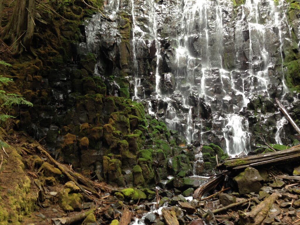
For lunch we took a side trail to Ramona Falls and were surprised by the number of day hikers there. The waterfall is a pretty nice spot for lunch though, if there is a trailhead handy. The moss on the rocks faded from green to rusty brown the further it was from the water, giving a lovely rainbow effect despite the shade of the trees. Rejoining the PCT we had another river crossing, Muddy Fork. Muddy for sure. This one had two sturdy logs across it though, so crossing was a piece of cake.
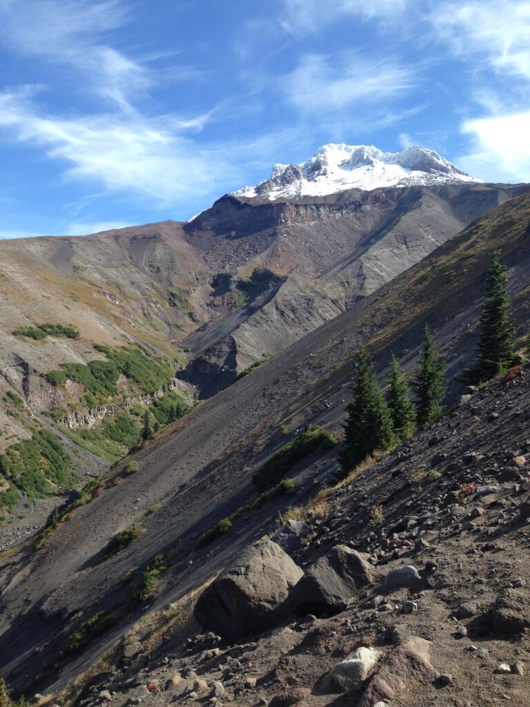

After the crossing came what must be the steepest hill in Oregon! The PCT doesn’t usually get very steep, because it is designed to allow passage for horses, so at nearly 750ft a mile the path up Bald Mountain is considered fairly tough. Not as tough as some of the climbs to come in Washington though.
Thankfully the hill had kept me warm as the wind was chilly, and it was the downhill that caused the bigger issues. For some reason putting on a sweater is too warm, but running is just right. So I ran a bit.
We met Horsing Around again at Lolo Pass at the bottom of the hill. She was done for the day and making camp with her dog Tucker. We still had several miles to go though so we said goodbye and headed up the hill. We leapfrogged with Chia Pet some more, and eventually camped with her by Salvation Spring leaving around 25 miles to the Washington border.
Leave a Reply